
The day started in Morganton, NC. I topped off and a guy wanted to talk about Colorado and his hunting trips in Paonia. I listened to the Boone and Crockett stories for a minute and then when he got distracted, I climbed on and rode off. Somehow, I ended up going east. Is this another byproduct of old age? You lose your unerring sense of direction? I was thinking, "Why is the sun in my eyes? It was in my eyes last night. It shouldn't be in my eyes in the morning." And then I noticed a sign for Hickory. I passed Hickory LAST NIGHT!!! Oh, well. That wasn't the only time I turned around today, or deviated from a course.
I was still on the interstate and as I got close to Asheville, I decided to stop and ride through the grounds of the Biltmore estate. Judy and I took the kids in 1998 when I ran a 10-miler there. We toured the place then and I knew it was an all-day deal so I just wanted a quick loop. Maybe see the estate from the outside. Well, that was a non-starter. Tickets are $60 a pop and once you're in, you're in to do whatever you want. Way too rich for a quick ride so I decided to just keep going.
Beautiful country, even on the interstate.
After Asheville, I got off on state road 23/74 and that led to 19/74. I was on the Appalachian Highway and the Great Smokey Mountains Expressway. As you can imagine, it was awesome. I was tooling along and looked over in the other lane and there were several emergency vehicles with lights flashing. I noticed a helicopter in the middle of them and thought it was either a crash or flight for life. Either way, I went to investigate. I pulled a u, stopped by the cop car, grabbed my camera and walked over. The helicopter was lifting off as I walked up.


The police officer came up as I was putting the camera back in the bag and told me the guy being airlifted was a motorcyclist. He'd hit a car and broke his leg. The accident was up the road in the direction I was heading and the first responders had to transport him to this area as it was the only place a helicopter could land. He told me to be careful, and I did another u and set out again.
I was soon in the Nantahala National Forest. Just sheer beauty. Tall trees standing sentinel, a river running along the two lane road. Really something to see.

I couldn't figure out how the guy had the wreck unless he was daydreaming. It, like every other road I've been on this trip, was winding and curvy, but nothing you couldn't do at 45 easily.
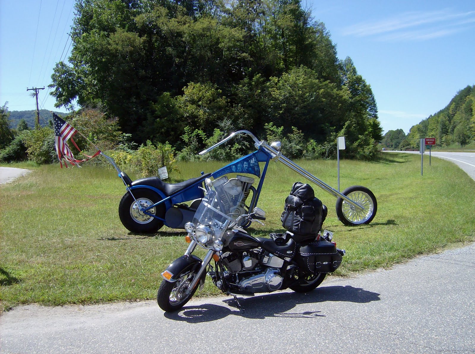
Got out of the forest and came upon this chopper sculpture. It was on the side of the road, in front of an independent bike dealer. Took the picture and rode on for the Tennessee line.
It took a long time to cross the state line from NC to Tennessee. You can't make a lot of distance on those winding two-lane roads in national forests (or even four lane in some cases) and hauling ass, burning pavement isn't the reason to be on them.
It was lunchtime when I got to TN. I was in the Cherokee National Forest at that point. I stopped and took a picture at a lookout point. Most of my ride has looked like this.


The road dropped from the mountain and the speed limit dropped quickly as well. I then found myself riding next to a river that turned into Ocoee Lake. It was huge. The two lane was slow due to the many, many curves. Winding around the lake, with the water just feet from the road, I was wondering once again how the Lewis and Clark kind of guys ever made it anywhere.
At Cleveland, TN I got back on the interstate and in Chattanooga, I pulled off to enjoy a few Krystal's sliders.


I talked to two managers in the store who told me Chattanooga is where Krystal's was born and I wouldn't have any trouble finding a store if I needed more burgers. They took my picture for me and I climbed back on the bike a short time later.
When I-75 headed south, I took I-24 west for a short distance and got off on state road 41. That was a mistake. The road was a disaster. Pavement was uneven - it looked like it had been patched by some first graders playing with slurry seal. I jumped off at Jasper and got on I-24 again for a few more miles. Crossed the Tennessee River. Just after Monteagle, I got off on state road 64 and headed west.
It was four lane for a while. The two lane scenic routes are being worked on to expand them to four lanes and that will be an even better ride. As it was, the ride shifted back and forth, four-lanes to two- and back again. The country was wide open. Still very enjoyable to look at and ride through. I hit a small town every thirty miles or so. Otherwise, it was just scenery. Some farms, some estates - all with lots of land. Plus, there were a few factories in isolated places. Not many, just a few in the middle of nowhere. One of my favorites:

I came in to Fayetteville (there's a Fayetteville in every southern state....), and after a quick ride through, I rode under I-65. South went to Huntsville, AL; north to Nashville.
In the next town, Lawrenceburg, there was this sign at the beginning of the town limits. I turned the bike around (two lane road with nowhere to go so I used a driveway) to get the picture. Unfortunately, I couldn't get the bike in the shot.

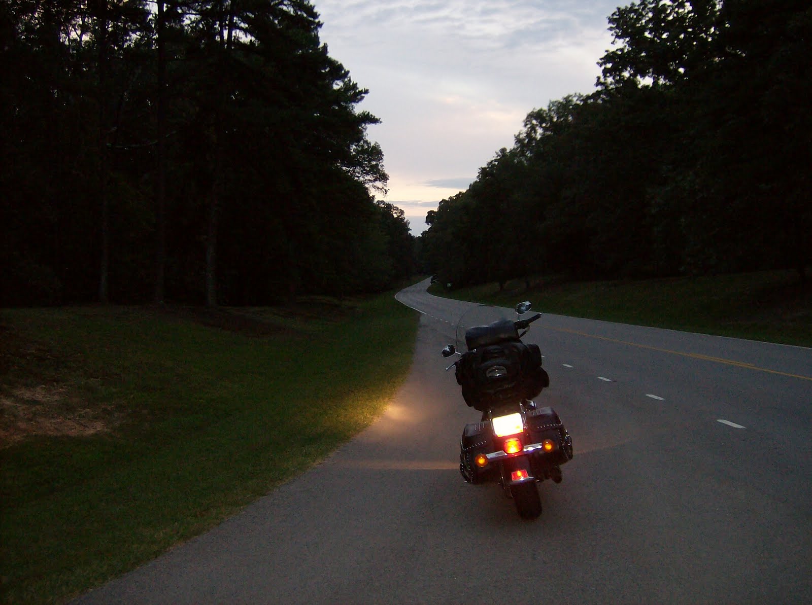
It was going to be dark soon and my plan all day had been to get as close to Memphis as possible. When I started this morning, I thought I might make Bolivar. As I drove and watched the sun begin to set, I knew I'd be riding in the dark to make it to Savannah, TN and even when I got there, I'd still be an hour away from Bolivar. That put Memphis at maybe another 150 miles or so (at least that's what an old-timer at a gas station told me).
I'd looked at the map from home repeatedly and when I thought I might go way south, I had eyeballed the Natchez Trace Parkway, 444 miles from Natchez, MS to Nashville.
http://en.wikipedia.org/wiki/Natchez_Trace_Parkway
Some miles after Lawrenceburg on a two-lane shifting to a four-lane to a two-lane to a four-lane (it had been like that for a while), I passed the cutoff for the Trace and a few things went through my mind - the road to Memphis is probably faster; the Natchez is something I won't see again; I can get to Tupelo and cut across to Clarksdale; when Judy and I drove through Tupelo in 1983 from Ft Benning on the way to Ft Carson in that behemoth rental truck, she wanted to stop at Elvis' birthplace and I was reluctant to drive that almost-a-semi-truck through the city so I still owe her; I'm going to be on the Trace in the dark; it's more than 100 miles to Tupelo and it's already been a long day.
Ah, what the hell. Let's go to Tupelo.
I turned around (once again - I am one spontaneous guy) and took the Trail. It was dark and the trees were close to the road in most places. "Looks kind of deer-y to me." But, I hadn't seen any of "caution deer" signs so I thought, or more likely it was wishful thinking, maybe there aren't any deer in Tennessee. Or not in Alabama, either (since the Trace cuts through Alabama on the way into Mississippi). No deer?!?!?! My father would have said, "Boy, you must be out of your mind."
Sure enough, I was 25-30 miles in (committed to it at that point) and two deer came out of the trees. They bounded back when the lights hit them instead of running in the road like deer stupidly do, and that put a damper on my fun factor. There was a cutout from the Trail to Florence, AL and I took it. At that point, even the drive on that dark state road for 15 miles into Florence looked deer-y. But, it was only 15 miles to town. East, of course. Man, I hate backtracking.
Rode around a few minutes looking for a place to stop. Naturally, I went the wrong way. It was a 50-50 shot on directions... I crossed the Tennessee River twice while I was doing the forced exploring. C'mon, Ralph, enough already. Find a hotel.
I climbed off the bike and it was 11.5 hours after I started. I had repeats on the Krystal's for a few hours so burping it up and tasting it took care of supper.
Tomorrow, I'll head west again to pick up the Trace. I should be in Tupelo in less than two hours. If I can find Elvis' birthplace without too much trouble, I'll pay my respects. For Judy. And get a picture. Then, it's on to the Crossroads.
Thanks for reading. And posting. I'm enjoying the ride more than I can convey. This isn't going to happen again for me (or at least this route won't) and I wish more of you could see this part of America. It's a heck of a country.


1 comment:
Hey- you've become my morning read. Really great stuff. I was thinking about Awareness. Really aware - you know, tho. What you're doing is a lot of work. Whaddya say we just fly accross America for Awareness? Would be a lot more convenient, and we can go to Sea World in San Diego. Would be money.
Enjoy the trip - not many guys get to do what you're doing. We really enjoyed your visit- so did Michael. Thanks. - Ski
Post a Comment