Ride Map

Thursday, September 16, 2010

Whew!!!

603 miles today. On the road for more than 13 hours. Again, more than I thought I was going to ride, but events conspired to keep me on the road.

I didn't get to bed until about 2 AM. I finished the blog after 1:15 since I know my loyal friends and family want to know where I am and what I'm doing. I was still pretty wound up after the big day so I read the paper and flipped channels. When I finally fell asleep, it was fitful and I woke up at 7:15. Not much rest.

I was out of the hotel and back on I-30 west, headed for Dallas, by 8:30. Usually when I start the day's ride, I have a shirt on over the t-shirt and my leather jacket with gloves. As the day warms, I progressively lose clothing. Today, however, the Texas heat was apparent when I walked out of the hotel. I rode today with just a t-shirt and it was immediately comfortable. I-30 must be a consumer goods corridor. There were hundreds of semi-trucks roaring up and down the highway. Hundreds. (Well, not in the picture but trust me, they were non-stop.)


You can't help but feel some apprehension when you're riding at 75 and passing them. I try not to think about what a blown tire would do to me... Ever the macabre...

East Texas is wide open.


I daydreamed as I rode, pretending to play cowboy. Riding my iron horse, with my helmet/cowboy hat and my work boots in lieu of cowboy boots, I was all set to ride the range except for my trusty six-shooter. Again, yet another reason to carry a weapon on trips like this. You can't be a cowboy without a Peacemaker.

At Greenville, about 45 miles before Dallas, I jumped off the interstate and caught a state road. 308, I think. It was two lane for a while and little traveled. As I came more north of Dallas, the road became four lane. McKinney, Denton and Decatur are towns in their own right but being only about 40 miles north of Dallas and Ft Worth, they've probably become bedroom communities for the commuters. The roads were crowded but still speedy. I stopped in Denton to run into a Kroger's, looking for Diet Big Red. Alas, they didn't carry it. No rhyme or reason why you can find a product made in Waco, Texas in a grocery store in Sellersburg, Indiana but you can't find it two hours away from the bottling plant.

At Decatur, I got on 287 and headed northwest. The road was four lane and absent of much traffic. The hours flew by and as late afternoon came on, I was in Childress when the clouds gave an indication that something would soon be amiss. I probably should have just stayed in the Quick Mart but I decided to take a chance. Hey, I've got rain gear if anything should happen. I was about 15 miles from that town when the first drops splattered hard. I wheeled quickly to the side of the road and donned the rain gear before taking off again. In moments, I was engulfed. I mean under water. It was unreal. I couldn't see anything. The windshield was covered with rain and despite the wind hitting it, the rain wasn't sliding off. I had water on both sides of the shield, both sides of my sunglasses, inside the rain gear, and of course, my boots were soaked. Again. I kept going, almost blindly, and noticed three cars had pulled to the side of the road. They wisely decided not to even attempt to drive in it. Having no where to go - when you're in the middle of the Texas plains, there's zero shelter - I elected not to stop with the cars and risk getting washed away. I rode like I was in a washing machine for about 15 minutes. I had so much water on my face, I was spitting it out. But, in short order, I left it behind. At the next town, I stripped down to t-shirt and jeans again, and replaced the rain gear in the saddle bags.

That didn't last long, though. I was 40 miles from Amarillo when it started again. At 60 miles out, the sky looked blue and cloudy ahead, but not a cause for concern. At 40 miles, however, the light blue color turned dark purple and it was as if night had fallen. It was 5:15 and I was plunged into darkness.


I could see ahead in the distance, and I assumed it was Amarillo, that the clouds were broken ahead and the sky was clear and blue, with plenty of sunny daylight.


I had the rain gear on again and it rained for 40 miles.

That road had paralleled a train track off and on for hours. In the rain, I noticed an engine coming my way. I pumped my left arm wildly, giving the engineer the universal sign for "blow the horn". He obliged with two long pulls. I tried to count the cars - he was pulling coal - and I came up with something like 90. It's hard to keep your eyes on the road in the rain with a windshield you can't see through while also attempting to count train cars. Unless you're Marty Feldman, that is.

Ten to fifteen minutes later, another train came toward me. Again, wet and feeling saturated, I reached out to the engineer and he obliged with a long pull. It made me grin when I thought about how old I was and still trying to get the train to sound the whistle... Admit it, you'd do it, too.

Once in Amarillo, I could see they'd had a strong storm. Behind me, the clouds were heavy, purple and showing no signs of breaking up. In the past, I'd driven by The Big Texan many times. Always either in a hurry to get somewhere else; or having eaten somewhere else and not hungry; or too early or too late to catch a meal, it just never worked out. I was determined to stop today. Getting out of the weather was only a small part of it - I wanted to continue my quest for the best chicken fried steak on the planet. "Now, here's a likely candidate to take the title," I thought.

I wheeled in and took a few pictures and then went inside.


It's a big place and as much a tourist stop as it is a regular place for locals.


What's made the name for the place is the "if you eat it, it's free" campaign. The billboards for The Big Texan appeared when I was almost four hours away. They do a booming business.

The catch is a $72 meal that you pay for and if you can eat it in an hour, you get your money back. While I was eating my meal, two young and slim guys decided to take the challenge. The restaurant has a table on a raised platform in front of the grill and one of the cowboy waiters announces to everyone (at least 200 people eating at long tables) that the competition is on. You have to eat a 72 ounce steak (that's 4 1/2 pounds), a shrimp cocktail, a salad, a baked potato and a roll with butter. In an hour or less. Joey Chestnutt, the professional eater who is the Nathan's Hot Dog Eating Champ, downed all of it in just under 9 minutes. A Siberian Tiger ate it in 90 seconds (just the steak). But, for most normal people, it's going to take the entire hour if you can do it at all. I might have attempted it in my prime and been a contender, but nowadays, there's no way to do that. Although, the record for the oldest person to successfully eat it all within the time limit is a 69 year old woman... Here's the web site with other information.

http://www.bigtexan.com/

Sadly, for me, a great chicken fried remains elusive. I was disappointed that even here, in the heart of beef country, I batted 0 for 2 for a good chicken fried steak. I know it's out there somewhere and it gives me purpose to continue looking.


When I came out after about an hour, Amarillo was wet and the clouds were still overhead but it looked like the rain was finished. I decided to keep riding instead of having a big day tomorrow. I pushed on for Tucumcari, NM on I-40. It's about 90 minutes from Amarillo and it was only 7:30 PM, so I thought I could handle it easily.

The sky began to grow dark as the sun set. Somehow I missed the Cadillac Ranch just outside of town.

http://en.wikipedia.org/wiki/Cadillac_Ranch

There's a big windmill farm west of Amarillo and I watched that for a while.

I noticed the sky was darkening to the southwest, more so than a normal sunset. As I rode, it grew darker and larger, and the clouds overhead also turned that ominous purple color. "Not again," I said to myself.

I kept riding and once I crossed into New Mexico, I could see that to the north, it was a clear and beautiful sky. To the south- and northwest, it was beginning to look like the end of the world. You can tell the difference between night and a nasty storm. Night is just dark; a dreadful storm is as black as an inkwell. Heavy rolling clouds were to my left and ahead to my right. I couldn't tell if they were coming at me or moving away. Then, the lightning show started. Lightning was dancing sideways between the clouds. I could see that somewhere not too far away, a storm of significant proportions was being let loose. It had to have been the same storm I twice encountered in Texas a few hours earlier, except this one had somehow increased in ugliness and vigor. I tried to outrun it by doing 75 - hey, it's an interstate. Trucks were barreling along and the wind was blowing. When I was 14 miles from Tucumcari, I could see the city lights. I made it to the first exit and quickly got a hotel room before this place got drenched.

So, not much to report today. Lots of miles and lots of wide open spaces and big sky country. The rain was just another event after all. And, as I write this, my boots are dry. I rode long enough after they got wet that the air dried them.

Tomorrow, I'm headed for Albuquerque and then I'll peel off on US 550 for either Cortez or Durango. Both routes are nice rides but I'm leaning toward the Cortez roads as they go through the Navajo Nation and the Ute Reservation. The topography is much different and for still another change in scenery, I'm thinking of driving through Moab on Saturday to get home.

Thanks for reading and for posting.

Tuesday, September 14, 2010

All Dorked Up

Eleven and a half hours and 500 miles. I'm beat.

The day started in Morganton, NC. I topped off and a guy wanted to talk about Colorado and his hunting trips in Paonia. I listened to the Boone and Crockett stories for a minute and then when he got distracted, I climbed on and rode off. Somehow, I ended up going east. Is this another byproduct of old age? You lose your unerring sense of direction? I was thinking, "Why is the sun in my eyes? It was in my eyes last night. It shouldn't be in my eyes in the morning." And then I noticed a sign for Hickory. I passed Hickory LAST NIGHT!!! Oh, well. That wasn't the only time I turned around today, or deviated from a course.

I was still on the interstate and as I got close to Asheville, I decided to stop and ride through the grounds of the Biltmore estate. Judy and I took the kids in 1998 when I ran a 10-miler there. We toured the place then and I knew it was an all-day deal so I just wanted a quick loop. Maybe see the estate from the outside. Well, that was a non-starter. Tickets are $60 a pop and once you're in, you're in to do whatever you want. Way too rich for a quick ride so I decided to just keep going.

Beautiful country, even on the interstate.

After Asheville, I got off on state road 23/74 and that led to 19/74. I was on the Appalachian Highway and the Great Smokey Mountains Expressway. As you can imagine, it was awesome. I was tooling along and looked over in the other lane and there were several emergency vehicles with lights flashing. I noticed a helicopter in the middle of them and thought it was either a crash or flight for life. Either way, I went to investigate. I pulled a u, stopped by the cop car, grabbed my camera and walked over. The helicopter was lifting off as I walked up.


The police officer came up as I was putting the camera back in the bag and told me the guy being airlifted was a motorcyclist. He'd hit a car and broke his leg. The accident was up the road in the direction I was heading and the first responders had to transport him to this area as it was the only place a helicopter could land. He told me to be careful, and I did another u and set out again.

I was soon in the Nantahala National Forest. Just sheer beauty. Tall trees standing sentinel, a river running along the two lane road. Really something to see.


I couldn't figure out how the guy had the wreck unless he was daydreaming. It, like every other road I've been on this trip, was winding and curvy, but nothing you couldn't do at 45 easily.

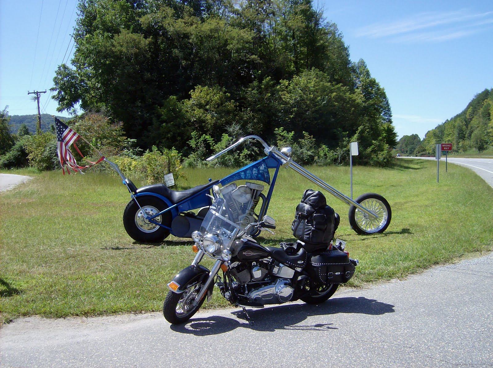
Got out of the forest and came upon this chopper sculpture. It was on the side of the road, in front of an independent bike dealer. Took the picture and rode on for the Tennessee line.


It took a long time to cross the state line from NC to Tennessee. You can't make a lot of distance on those winding two-lane roads in national forests (or even four lane in some cases) and hauling ass, burning pavement isn't the reason to be on them.

It was lunchtime when I got to TN. I was in the Cherokee National Forest at that point. I stopped and took a picture at a lookout point. Most of my ride has looked like this.


The road dropped from the mountain and the speed limit dropped quickly as well. I then found myself riding next to a river that turned into Ocoee Lake. It was huge. The two lane was slow due to the many, many curves. Winding around the lake, with the water just feet from the road, I was wondering once again how the Lewis and Clark kind of guys ever made it anywhere.

At Cleveland, TN I got back on the interstate and in Chattanooga, I pulled off to enjoy a few Krystal's sliders.


I talked to two managers in the store who told me Chattanooga is where Krystal's was born and I wouldn't have any trouble finding a store if I needed more burgers. They took my picture for me and I climbed back on the bike a short time later.

When I-75 headed south, I took I-24 west for a short distance and got off on state road 41. That was a mistake. The road was a disaster. Pavement was uneven - it looked like it had been patched by some first graders playing with slurry seal. I jumped off at Jasper and got on I-24 again for a few more miles. Crossed the Tennessee River. Just after Monteagle, I got off on state road 64 and headed west.

It was four lane for a while. The two lane scenic routes are being worked on to expand them to four lanes and that will be an even better ride. As it was, the ride shifted back and forth, four-lanes to two- and back again. The country was wide open. Still very enjoyable to look at and ride through. I hit a small town every thirty miles or so. Otherwise, it was just scenery. Some farms, some estates - all with lots of land. Plus, there were a few factories in isolated places. Not many, just a few in the middle of nowhere. One of my favorites:


I came in to Fayetteville (there's a Fayetteville in every southern state....), and after a quick ride through, I rode under I-65. South went to Huntsville, AL; north to Nashville.

In the next town, Lawrenceburg, there was this sign at the beginning of the town limits. I turned the bike around (two lane road with nowhere to go so I used a driveway) to get the picture. Unfortunately, I couldn't get the bike in the shot.


It was going to be dark soon and my plan all day had been to get as close to Memphis as possible. When I started this morning, I thought I might make Bolivar. As I drove and watched the sun begin to set, I knew I'd be riding in the dark to make it to Savannah, TN and even when I got there, I'd still be an hour away from Bolivar. That put Memphis at maybe another 150 miles or so (at least that's what an old-timer at a gas station told me).

I'd looked at the map from home repeatedly and when I thought I might go way south, I had eyeballed the Natchez Trace Parkway, 444 miles from Natchez, MS to Nashville.

http://en.wikipedia.org/wiki/Natchez_Trace_Parkway


Some miles after Lawrenceburg on a two-lane shifting to a four-lane to a two-lane to a four-lane (it had been like that for a while), I passed the cutoff for the Trace and a few things went through my mind - the road to Memphis is probably faster; the Natchez is something I won't see again; I can get to Tupelo and cut across to Clarksdale; when Judy and I drove through Tupelo in 1983 from Ft Benning on the way to Ft Carson in that behemoth rental truck, she wanted to stop at Elvis' birthplace and I was reluctant to drive that almost-a-semi-truck through the city so I still owe her; I'm going to be on the Trace in the dark; it's more than 100 miles to Tupelo and it's already been a long day.


Ah, what the hell. Let's go to Tupelo.


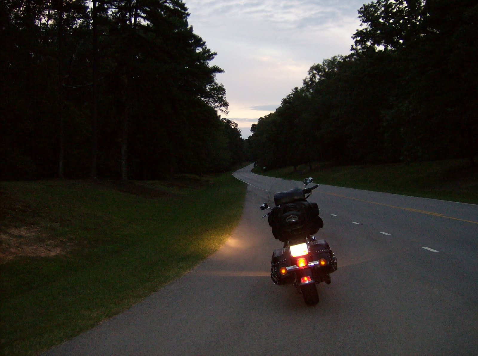
I turned around (once again - I am one spontaneous guy) and took the Trail. It was dark and the trees were close to the road in most places. "Looks kind of deer-y to me." But, I hadn't seen any of "caution deer" signs so I thought, or more likely it was wishful thinking, maybe there aren't any deer in Tennessee. Or not in Alabama, either (since the Trace cuts through Alabama on the way into Mississippi). No deer?!?!?! My father would have said, "Boy, you must be out of your mind."


Sure enough, I was 25-30 miles in (committed to it at that point) and two deer came out of the trees. They bounded back when the lights hit them instead of running in the road like deer stupidly do, and that put a damper on my fun factor. There was a cutout from the Trail to Florence, AL and I took it. At that point, even the drive on that dark state road for 15 miles into Florence looked deer-y. But, it was only 15 miles to town. East, of course. Man, I hate backtracking.


Rode around a few minutes looking for a place to stop. Naturally, I went the wrong way. It was a 50-50 shot on directions... I crossed the Tennessee River twice while I was doing the forced exploring. C'mon, Ralph, enough already. Find a hotel.


I climbed off the bike and it was 11.5 hours after I started. I had repeats on the Krystal's for a few hours so burping it up and tasting it took care of supper.

Tomorrow, I'll head west again to pick up the Trace. I should be in Tupelo in less than two hours. If I can find Elvis' birthplace without too much trouble, I'll pay my respects. For Judy. And get a picture. Then, it's on to the Crossroads.


Thanks for reading. And posting. I'm enjoying the ride more than I can convey. This isn't going to happen again for me (or at least this route won't) and I wish more of you could see this part of America. It's a heck of a country.

Monday, September 13, 2010

Rideabout

One of my friends in Texas said I was going "rideabout". I think that's appropriate. I did 535 miles the hard way today. It was fun but long - more than 11 hours on the road - primarily because the scenic routes are slow-going (less than 60, anyway). It's worth it. The scenery is so beautiful, you want to thank Woody Guthrie. "This land is your land, this land is my land, from California..." etc etc.

I left the Ski's this morning about 8:30 after a quick picture with Michael.


As Sharon took Michael to school, Ski led me out of the city.


I couldn't have done it without the guide. It was a mess - lots of early morning rush hour traffic and several different roads and highways. I was glad Ski was ahead of me in his brand new truck, albeit a brand new truck with its first ding. Which makes it a truck that you can now just give away. It's no good anymore.

Just before we parted on the highway, the fog rolled in. I rode in it a while and then decided to put my chaps on. I pulled off and struggled with them and sure enough, by the time I got to Manassas, the fog was gone. Getting them off was worse than putting them on so I put on a show in a Walgreen's parking lot...

I rode into the Shenandoah National Park. The road is called the Skyline Drive and sure enough, you are up in the air.


It's a beautiful place but the speed limit is only 35. Most people were doing 45 until the curves and then it was throttle back and downshift. That was more than a two hour ride with some shallow and some steep curves, winding roads, lots of trees and frequent cutouts for scenic views. Very pretty park and an enjoyable ride. Here's the skinny:

http://en.wikipedia.org/wiki/Skyline_Drive


After you come down from the mountain, you exit the Shenandoah National Park and almost immediately you're on the Blue Ridge Parkway. The speed limit is higher and the curves aren't as severe so you can really move. It, too, is tree enclosed and full of shadows. The good thing about the ride today is there was very little traffic. I saw more motorcycles than cars. As I headed south, I noticed I was less than half full. And no petrol stations anywhere. I didn't know if I could find a place to tank up so I was trying to figure out the point of no return on the reservoir. I looked ahead and there on the road, in the middle of nowhere, was a guy on a bicycle. Those guys are everywhere. Rail thin, muscles like ripcords, they're what a whippet would look like if it was human. I slowed down, pulled abreast and asked him about gas stations. He said there wasn't anything between where we were and Roanoke. That wasn't good. I decided to pull a u and I backtracked to get out of the Parkway. (It turns out I could probably have gotten gas at Buena Vista but it worked out OK anyway.) Once back at the start point between the Shendandoah Park and the beginning of the Parkway, I caught I-64 and soon ended up on I-81. I didn't want to do the interstate but I'd been yimyamming around and I was never going to get out of Virginia otherwise. At least I wasn't going to get out at that rate while the sun was up. The state is amazingly beautiful and I'll bet in a few weeks, when the leaves start to color and fall, it'll be breathtaking. That would be the time to ride.

I hit the interstate hard and tried to blow out the carburators. At Roanoke, I peeled off and got back on the Parkway.


What a ride the Parkway is. As Bob Sims said, "Biker nirvana." Some info for wikipedia fans:

http://en.wikipedia.org/wiki/Blue_Ridge_Parkway


I got off the Parkway at Fancy Gap and drove state road 52 into Mount Airy, NC. It seemed like it was almost 12 miles of downhill curves. That couldn't be.... S-curves the entire way down the mountain, all between 45-55 mph. Really fun. (Do the hand.) I got into Mount Airy at 5, so things were closing but I was able to talk to the lady in the Visitor's Center. The Center is downtown, right on Main Street. The pace in Mount Airy is slow, the drawl is thick and even slower. While the town doesn't look like Mayberry, Andy Griffith got his inspiration there. (He was born there.) The woman in the Visitor's Center talked loud, slowly and very heavily, heavily accented. She scared me so much, I said, "Yes, ma'am" to her. I was thinking, "No one really talks like this." But, I listened to her for a while and she was the real deal. Next door to the center was Barney's Burgers - an obvious attempt to capitalize on Mr. Fife's popularity:


Down the street was Floyd's barber shop. There were two characters sitting out front on a bench. I was tempted to ask if one of them was named Emmit. They were nice guys, though, and offered to take a picture of me in front of the shop. One of them said he'd had a haircut that day by Floyd. I asked if his name was really Floyd. Sadly, it wasn't. I don't think he talked like Floyd either. The place was closed so I looked in the window. Nope. Wasn't Floyd's barber shop like on the show. He gives a good haircut, though, judging by the loafer on the bench in front of the shop. $8. I'll bet he makes a fortune - cutting hair for tourists so they can say they had their hair cut at Floyd's.


I rode over to the Andy Griffith Museum and had a guy take my picture with the Andy and Opie sculptures/statues.


I'm not in many pictures - my bike is making them all, though. It's like a kidnapped garden gnome - the bike is on vacation and you have to wonder where it will turn up next. This is the Andy/Opie shot but from the street. I was considering riding the bike on the sidewalk to get next to the statues but the Mount Airy Police Department is right next to this picture. I don't think they'd be as forgiving as Andy. More likely, I would have gotten a ticket, ala Barney. Probably a Section 415.


The picture taker told me he'd lived there his entire life and then he invited me to church. I declined and got back on the road. It was getting late and instead of backtracking to return to the Parkway, I headed west on I-74 for a few minutes, then south on I-77 until I caught I-40 west. I broke the rule about riding on the interstate but when you make 'em, you can break 'em. I was worried about deer in the mountains so the Parkway had to be a no-go. I guess I could have stayed in Mayberry/Mount Airy, but I felt like riding some more. The sun went down when I got on I-40 and the glare was blinding. I'll stop tomorrow before I ride into the sun again. Probably not smart riding blind on the interstate.... I rode on in the dark after the sun disappeared and at Morganton, NC, I'd had enough and finally pulled over. I was still wearing my sunglasses like a moron.

Another great day of riding. I've had a good trip - even with the rain and wet boots... Got to see friends and family, and got to put some serious miles on the bike.

I'll hit the road early tomorrow. I'm going to try to get home by Saturday sometime. Along the way, I want to find a Krystal's. I know that's no culinary treat for most people but in January, when I was headed for Alabama, I did a taste test between Krystal's and White Castle. It's heresy for me to say this, but Krystal's won easily. I won't pass up a White Castle but I'd rather find a Krystal's. I didn't eat today so I'm probably turning this into something more delicious than it really is....

Later. Thanks for reading and for posting.

Sunday, September 12, 2010

At the Ski's

On Friday, Ski took the afternoon off and we headed for the range, taking his black powder muzzle loader, an M-14 and an AK47. Put some lead downrange and had a good time doing it. Ski is well known as a good shot - he can pound nails with any caliber. So, that was fun. Pizza that night at a local pizza place.


Saturday morning was Michael's soccer game. Michael goes all out. He's fast and intuitive - he reminds me of Spencer as a boy. Wiry and cut the same way, and just as enthusiastic about playing. Coach did a bang-up job and all the kids played just about equal amounts of time. "Good game, good game, good game" high fives at the end.


After the game, we drove to the local Dick's Sporting Goods where I found a good rain suit. I bought one in the golfer's section - two-piece, lightweight and flexible. And on sale. Good deal. I'm hopeful it can stay packed but if the weather today is an indicator of what I'll be seeing on the route home, I'll be wearing it a lot. It hasn't rained in a month here, but it poured last night.

Yesterday evening, some friends came over for dinner (Dave and Bao; Jeff, Colleen, Lindsay and Emily). Sharon grilled salmon. Among other things she made, there was HOMEMADE ICE CREAM!!! Chocolate with raspberries and strawberry with chunks of strawberry. I've already called Judy and told her our lives aren't as complete and satisfied as we believed them to be since we don't have one of those ice cream makers. We'll have one by the end of the month, I bet. But, since I'm still trying to lose more weight, I'll just look at it.

It rained last night and is still wet and gloomy this morning. I was going to leave at midday but I don't want to ride when it's like this unless I really have to so I'll leave tomorrow morning. The weather is forecast to be sunny. It'll take me over an hour to get to the top of the Blue Ridge Parkway and once there, I'll head south with a stop at Mount Airy, NC.


Thanks for reading and for posting. More tomorrow from wherever I stop.

Friday, September 10, 2010

Antietam, Harpers Ferry and Ski's

I spent the Wednesday night in Martinsburg. I left the hotel about 8:30 and headed east toward Antietam. Two lane roads again in country that looks little touched since the civil war. I picked a good day to go as it wasn't crowded and the weather was nice (until the thunderclouds formed and made me think, "C'mon, not again."). But luck held and they blew away instead of opening up with a downpour.

I crossed the Potomac and was in Maryland. Short ride later and I was at Antietam.


Just before you arrive at the National Battlefield, you pass through Sharpsburg and Shepardstown, both of which are historic and patriotic. Many properties fly flags and banners, and on some of the houses are stars. Ski told me last night the stars indicate the houses were there during the Civil War.

Pretty sure everyone remembers their history, but for a quick refresher, here's a link:

http://en.wikipedia.org/wiki/Antietam

I watched a movie in the museum and looked at the exhibits before wandering outside.


There were more than 100,000 men on the field that day and after the battle, 23,000 were either dead, wounded or missing. It's hard to even imagine it. You read about it in history books and then to see the terrain certainly puts it in perspective, but it remains difficult to visualize what a nightmare it must have been. Three million bullets were fired that day. Just unreal.

You need a vehicle to tour the entire battlefield so I rode the bike to most of the designated markers. My pictures really don't help anyone better understand it, I don't think.


I rode from there to Harpers Ferry (no apostrophe for some reason). More back roads, up and down gentle hills and easy curves.


Same deal for a quick refresher (I like Wikipedia...):

http://en.wikipedia.org/wiki/Harper%27s_Ferry

At Harpers Ferry, you catch a shuttle and take a 2 1/2 mile ride to the lower town. There are Park Rangers walking around to answer questions, but you're really on your own. Got some photos of John Brown's fort. It was originally at the site of the obelisk:


But, like the marker indicates, it was moved about 150 feet from the top of the hill:


And here's the confluence of the Shenandoa and the Potomac which made Harpers Ferry a travel route for Indians and explorers. Spectacular:


Lewis and Clark were even there, preparing for their trip. I thought this was an interesting story:


This is the replica of the boat they reference in the marker blurb. By current standards, there's nothing to it. A few pieces of thin metal that you put animal hides on? Man, the early explorers were more hardy than people can imagine:


Afterwards, I caught the shuttle back to head for Ski's. I heard an older woman speaking German to a man and woman so my ears picked up. I started talking to them and found they were from Stuttgart. The one woman had said to the other that after all the places they'd been, they probably knew more about American history than most Americans. She had an accent like my mom's and it was nice to yak with someone from the Old Country. We parted when the shuttle stopped and I was gearing up to leave. They passed me in the parking lot and gave big waves. Nice people.


I had good directions to Ski's but as I got close to the house, I was certain I missed a turn. I stopped on the shoulder and grabbed the gps. I hadn't uploaded the most current maps before I left so I should have been prepared for what happened next. Ski and Sharon had told me to come down a main thoroughfare and I'd driven for what I thought was too long. Instead of continuing on the road, I had a nagging feeling I missed the turn. The gps told me to get off the road I was on, take the toll road, make a few turns and I'd get to Ski's house. I sat on the bike, looked around and everything was familiar but I couldn't quite get my head around it. So, instead of going straight, I jumped on the toll road for about a mile. An unmanned booth took $4 off my credit card and then I circled around. I missed the turn to their house and as I u-turned, I looked off to my right and could see where I had been sitting 10 minutes before. The gps didn't know the road went all the way through so it took me on a circuitous route. If I'd ridden straight for another 100 yards, I would have been on the right street. Instead, I did roundabout to get there. Pretty stupid.

Met up with Sharon and we headed for Wegman's. (If you've never been in a Wegman's, you have to put it on your things-to-do list.) Some quick food shopping and then back to the house. Ski showed up soon after. Sharon picked Michael up and we headed for soccer practice. Michael is a great kid. He'll be 7 in November and is smart, funny, inquisitive, polite - I'm very impressed with him. And, he has one speed - all out full. Supper was grilled steak, salad and corn on the cob - everywhere I've been, people are feeding me really well on the trip.

Michael has a soccer game Saturday morning. The coach will be out of town, so Ski is subbing. He told me he's going to buy some of those short shorts coaches wear, get a whistle, a ball cap, and of course, a clip board. A speedwatch is another good thing to wear around your neck. You never know when you're going to have to time 6 year olds... Eight boys on a team; four playing at any time. Four quarter so everyone gets equal playing time. Should be lots of fun. It reminds me of when I coached soccer for Ruppert and Reilly when we were in Hanau. Reilly quit during the first practice and Rup chased the ball. Actually, all the kids chased the ball. It was like a snake every game. No positions, nothing. Just kick and run. It was fun, though. I let all the kids pick the name of the team and they came up with the Brown Three-Headed Timberwolves...
Anyway, looking forward to Michael's first game this year and to watch the coach run up and down the sidelines, yelling encouragement. As spectators, Sharon and I should have a blast.
I'll likely take a few days off on the blog. I anticipate leaving on Sunday but it's weather dependent. Even though I'm going to buy some rain gear while I'm here, I don't want to ride through it if I can help it. I woke up with a head cold this morning and I suspect it's from wet boots. Note to self: Next time, bring an extra pair of boots.
Thanks for reading and posting. I'll be talking to you.